
 Written by
 Notes from a GIG community call on open technologies, locally generated data and environmental challenges
Four centimetres. That is the resolution of the drone imagery Tommy Charles showed us from Freetown, next to a satellite picture of the same street that blurs everything below twenty or thirty centimetres into a grey smudge. At four centimetres you can count roof sheets, see which wall is cracked, tell a football field from a market. That single comparison carried most of what this GIG community call, held on September 9th, was really about: who gets to produce the data that describes a place, and what changes once they do.
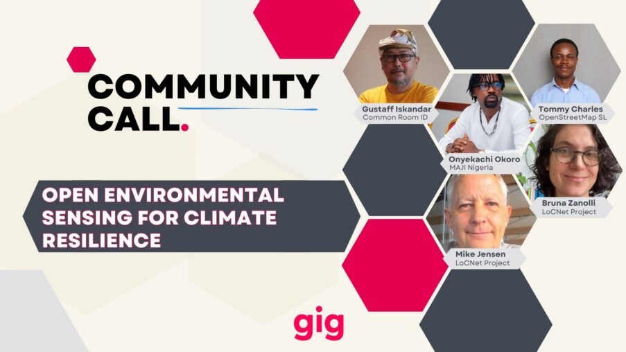
The call brought together practitioners from four continents around one shared thread. Gustaff Iskandar joined from Common Room in Bandung, Bruna Zanolli from Rhizomatica joined from São Paulo, Tommy Charles from OpenStreetMap Sierra Leone joined from Freetown itself, Onyekachi Okoro from the Media Awareness and Justice Initiative (MAJI) joined from Port Harcourt, and Mike Jensen from APC added context throughout, with Fadia and Geraldine hosting for GIG. As Fadia put it at the close, it was Tommy’s work that had been the spark pulling the rest of the conversation together.
Gustaff opened with a story that starts with connectivity and ends somewhere else entirely. Common Room’s School of Community Networks began in 2021 to build technical and digital literacy alongside community centred connectivity pilots, and by now covers twelve project sites across eleven provinces, several on remote islands, in forests, along the coast (Weaving Meaningful Connectivity). The technical problem, it turned out, was the smaller half of the story.
The larger half was climate. Most of those pilot sites sit in disaster prone geography, close to active volcanoes or fault lines, exposed to earthquakes, tsunamis, forest fires. Farmers and fishers there carry precise, inherited knowledge of local water and weather, knowledge that is disappearing as government led mechanisation pushes out the agroecological practices it came from. Common Room answered with open source weather stations for microclimate data, then with solar powered irrigation tools, connectivity and local service braided into one thing instead of two.
Bruna Zanolli picked up a thread running under everyone’s presentation: what “meaningful” connectivity means once you get past speed and device access. Rhizomatica and APC’s Locnet initiative opened a call for narratives on climate, social and environmental justice earlier this year and received 125 stories back (Local narratives: community centred connectivity initiatives driving socio-environmental change), a number she read less as a statistic than as proof of how many people are already doing this work without waiting for permission.
Her warning mattered as much as her enthusiasm. She named technosolutionism directly, the industry habit of answering a complex social question with an app, and insisted that communities themselves have to decide which technologies they want and where their own data lives. Not with big tech, and not handed down from the top. Community Box (coolabnet.github.io/community-box), the matchmaking platform she is building to help communities find the right server and hardware for their own needs, is one attempt to make that autonomy something you can actually click on.
Two of the narratives Locnet has already published make the point in practice: one from CITAD in Kano, Nigeria, sending real time alerts when a river is too polluted to drink or irrigate with, another from a community living beside a factory in South Africa, sensing its own air. Social justice comes first, Bruna said, environmental justice stands right beside it, not above it.
Then Tommy Charles walked us through what OpenStreetMap Sierra Leone has built since 2021: youth mappers, open mapping trainings, and a 2025 drone campaign that photographed the whole of Freetown at that four centimetre resolution (Freetown Open Drone Crew Imagery), an orthomosaic the city council now reads for urban and environmental trends. A second layer maps the city’s regeneration project point by point (Freetown City Regeneration Project points).
The harder problem was sitting inside Sierra Leone’s informal settlements, where crowded, unmapped footprints turn a simple GPS coordinate into chaos, aid sent to the wrong door, a household counted as one when it was really four. Tommy’s team trains community members as drone pilots and enumerators rather than flying in outside contractors, then profiles every building, road and drain by hand. In Koku Bay, what old satellite imagery read as a single structure turned out to hold four separate households once the drone flew low enough to show it (J Mata community profile). A vulnerability survey there counted 690 residents, 125 households already short of water, most living under uninsulated zinc roofing that turns every dry season into a heat problem worth its own map.
The same infrastructure answers a different kind of emergency. Twahir Hussein Kassim, joining from Kenya, asked in the chat whether OpenStreetMap could pair with WhatsApp or SMS to track which neighbourhoods were still without power during a blackout. Tommy’s answer already existed: ChatMap, built originally to track drone pilots’ live locations in the field, lets anyone drop a pin and a photo into a shared group that cascades straight onto a map, the same tool that could tell a fire brigade or a power company exactly where to go.
Onyekachi Okoro closed the presentations with the sharpest line of the call. MAJI works in the Niger Delta, where oil is the country’s main income and pollution is a daily condition rather than an event. Nigeria’s environmental policy is strong on paper, Okoro said, the failure sits entirely in implementation, and the government agency responsible for tracking spills had no technology to collect the data implementation depends on. MAJI trained the national oil spill agency’s zonal office on low cost air and water sensors, including Raspberry Pi builds cheap enough for a community member to assemble, and within two weeks the national office asked for that training rolled out across every zone in the country. DataCab (www.datacab.io) now shows real time air pollution readings from the Niger Delta to anyone who wants to look.
“How can you demand reparation when you can’t cost what you can’t quantify,” Okoro asked, and the rest of his answer mapped out who needs that quantification most: the communities carrying the pollution directly, journalists who currently report incidents without the where, when or how much that real data supplies, the CSOs who bring documentary footage into boardrooms only to meet silence once the science goes missing, the government agencies and oil companies who cannot be held accountable for harm nobody measured, and academia, especially the students at the University of Port Harcourt who come from the very communities they could be studying.
The clearest proof of what that quantification can do is the case MAJI helped bring for the Ogale and Bille communities against Shell, through the UK firm Leigh Day, now before the UK Supreme Court with 13,600 people signed on. MAJI’s own site (www.majinigeria.org) carries more of that story.
Mike Jensen widened the frame with examples from across APC’s network. Colnodo in Colombia is training an audio classifier to detect illegal logging by sound in the Amazon (Detecting illegal logging sounds with an audio classifier on Vertex AI), a comparable acoustic system helps villages in Myanmar recognise incoming aircraft and take shelter, and OSPIT (Meet OSPIT: a sustainable energy and irrigation solution) treats solar power, irrigation and connectivity as one system instead of three separate projects. A civic sensing initiative in Taiwan (OCF Civic Sense) showed the same pattern holds even outside the disaster prone geographies most of the call was rooted in.
Geraldine and Fadia used the last minutes to name what still has no clean answer: how citizen generated data actually reaches a city government or a national ministry in a way that builds a feedback loop rather than a report nobody reads back. Óscar González from IAAC in Barcelona jumped into the chat offering to compare notes from Smart Citizen, CitiObs and more4nature, three sensing projects facing the same question from a more urban angle. That gap between collecting data and being heard with it ran under every presentation without quite closing, which is probably why the chat was already asking for a part two before Fadia finished saying goodbye, from Rachel Firestone’s quick yes to Kersti wondering aloud whether any of this applies to data centre research. Felipe Schmidt Fonseca left the door open on his way out: GIG’s Discourse keeps an Environmental Hacklabs category alive for exactly this conversation, and Documental (documental.xyz), a geospatial storytelling tool GIG member Adriano Belisário helped build in its earlier versions, is one more place this keeps growing. We came out of an hour and a half with more sensors, more maps and more open questions than we started with, which is probably the right ratio for a network that would rather measure its own air, water and land than wait for someone else to do it.
More links shared during the call
- Felipe Schmidt Fonseca’s collection of geospatial and open source bookmarks: https://links.efeefe.me/?searchterm=&searchtags=geolivre+
- To join GIG’s Discourse and the Environmental Hacklabs group, reach out to Felipe: [email protected]
- To follow up with Onyekachi Okoro and MAJI directly: [email protected]
- To connect with Óscar González on Smart Citizen, CitiObs and more4nature: [email protected]